Overview
Map Setup allows administrators to plot and map out buildings across one or more floors. Any devices that exist withing the SureView system can be plotted on the map for use within events.
Prerequisites
In order to use the map setup interface, you must:
- Have the "Map Setup" feature enabled within your Feature Setup.
- Have the "View and Edit Map Setup Page" permission.
Installation
Map Setup is available within the core product from version 1.3+.
Accessing Map Setup
To access Map Setup you need the feature Map Setup enabled within your features list. This will add the required menu option.

Creating A Map Layer
Map Setup will open on the global view. To begin mapping your buildings, search for your area using the tree on the left hand side of the screen.
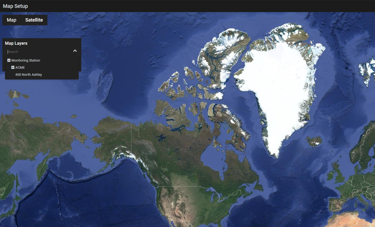
Once you've selected your area, click the "ADD LAYER" button.

This will show the layer editing modal on the right hand side of the screen. Here you can set your layer name, add your floorplan and specify it's elevation.
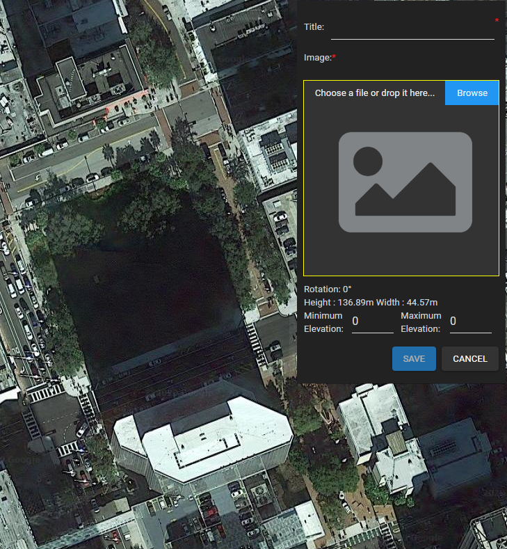
While the layer editing modal is visible, you are able to draw the outline of your layer onto the map, resize, rotate, and reposition the outline.
Plotting Map Items
Once a layer has been selected, items can be plotted on a map using the top toolstrip. Simply click the type of item you wish to plot, then the location on the map where the item should be added. Shortcuts are also available.

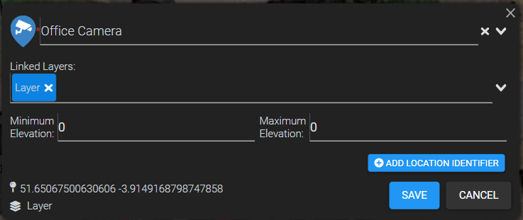
Upon placing a new marker the Map Item details modal will appear allowing you to select a linked device for this map item, any map layers that this map item is linked to and the elevation of this map item. In the bottom left of the map item details modal the current layer name is displayed along with the coordinates of the map item.

Viewing existing Map Layers
To view or update an existing Map layer, select the area that your Map Layer belongs to from the tree search in the panel on the left. Once the area has been selected a list of map layers belonging to the selected area will be shown.

- The Eye Icon will toggle whether a Map Layers floor plan and Map Items are visible on the map.
- Clicking a Map Layers name will toggle showing that layers Map Items in the list.
- The highlighted blue number indicates the number of child items the Area or Map Layer has.
- The pencil icon allows you to edit that specific Map Layer
Editing a Map Layer
To edit an existing Map Layer click the edit icon for the Map Layer you wish to edit.

This will show the layer editing modal on the right hand side of the screen allowing you to update the Map Layers Title, Floor Plan and Elevation.

Along with this you being able to resize, rotate and reposition the floor plan within the map using the handles

- Hold Click and drag inside the handles to move the Map Layer.
- Hold Click and drag the corner dots to resize the Map Layer.
- Hold Click and drag the large white dot (right at 0 rotation) to rotate the Map Layer.
Should you wish to delete a Map Layer, click the red delete button in the layer editing modal. This will open a confirmation dialog asking you to confirm the deletion of the Map Layer. Note: This will also delete all Map Items for this Map Layer that are not linked to another Map Layer.

Viewing existing Map Items
To view an existing Map Item navigate to the selected Map Layer. Now expand the Map Layer to show its Map Items by clicking its name. Select the desired Map Item from the expanded list by clicking on either the Map Items name or the edit icon.
Alternatively you may select the Map Item by clicking its marker on the map (ensure the map layer is set to visible).

Once a Map Item has been selected Map Item details modal will appear above the Map Items position allowing you to view the selected Map Items details.

Editing Map Items
To edit a Map Item view the Map Item as normal and click the edit button in the bottom right corner of the Map Item details modal. This will allow you to update the linked device, linked layer and elevation of the Map Item.
In addition, each map item can be given a unique location identifier such as a GUID. The ability to add a unique location identifier to each map item requires the "Mobile/CheckIn" feature to be enabled within your Feature Setup. The unique location identifier allows guards to check into assets when dispatched to an alarm or tour. This check in can be done by scanning a QR code, NFC point, RFID point or any other third party points with a mobile phone. More on this feature can be found here.
When the "Mobile/CheckIn" feature is on, a "ADD LOCATION IDENTIFIER" button is present when editing a map item. An example can be seen below:
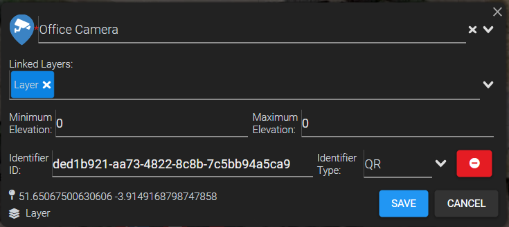
Clicking this button will allow the user to add a location identifier ID and select the Identifier type (QR, NFC, etc). An example of this can be seen below:
Deleting Map Items
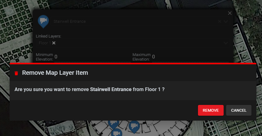
If you wish to delete the Map Item instead click the red delete button in the bottom right corner. This will open a confirmation dialog asking you to confirm the deletion of the Map Item.
Moving Map Items
To Move a Map Items position select the Map Layer as normal however to do not select a Map Item to view its details. Instead click and drag the selected Map Item Marker to the desired position.
Once a Map Item marker has been moved a confirmation will appear in the top right corner to confirm the changes you have made to the position of the Map Item Markers.

Comments
0 comments
Please sign in to leave a comment.